Authentic WW1 & WW2 German Militaria

Original WWII German Industrial Map Wesseling Oil Plant Bomb Damage 1944 Plan
Original price was: $125.00.$100.00Current price is: $100.00.
1 in stock
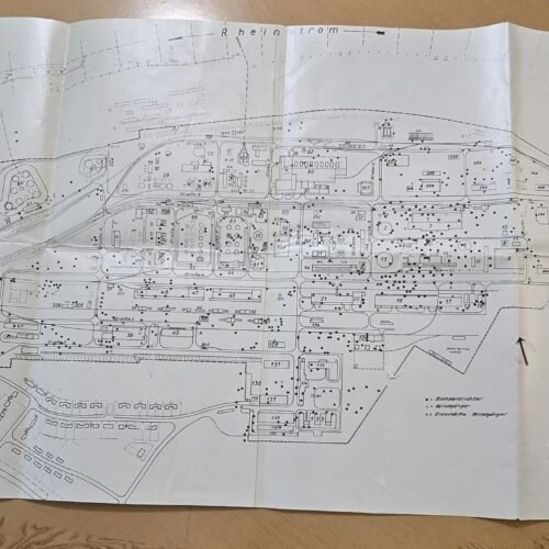
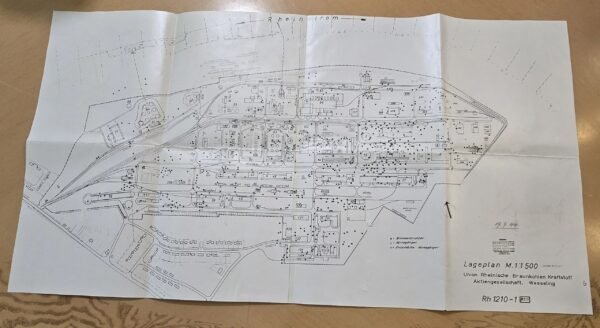
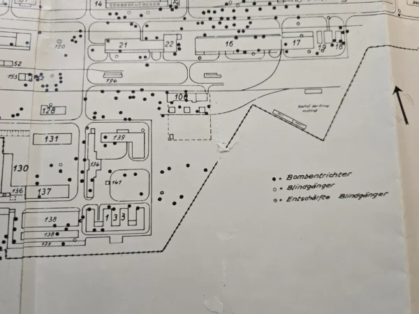
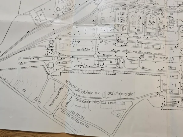
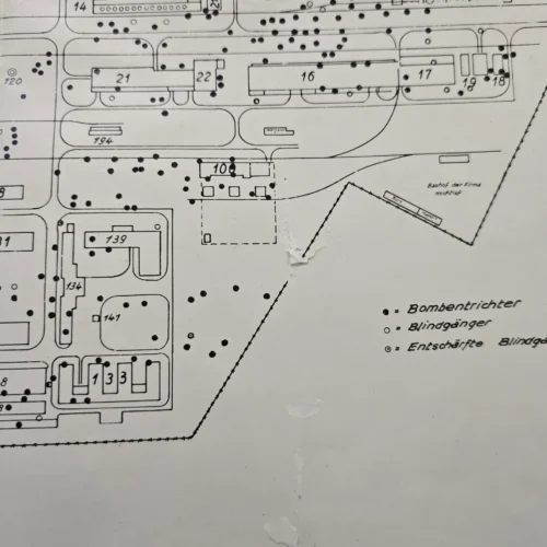
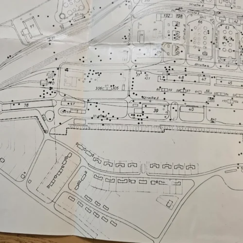
Original large-format WWII German industrial site map dated July 19, 1944, measuring approximately 28 x 16 inches. This is a highly detailed “Lageplan” (site plan) of a major synthetic fuel facility in Wesseling, Germany, located along the Rhine River.
This is not just a map — it is a bomb damage assessment / operational layout of one of Germany’s critical wartime fuel production plants.
Translated Text (full, line-by-line where visible):
“Lageplan M. 1:1500”
→ Site Plan, Scale 1:1500
“Union Rheinische Braunkohlen Kraftstoff Aktiengesellschaft, Wesseling”
→ Union Rhenish Brown Coal Fuel Corporation, Wesseling
(Important: This was a major synthetic fuel producer using coal to create gasoline for the German war effort.)
Handwritten date:
“19.7.44”
→ July 19, 1944
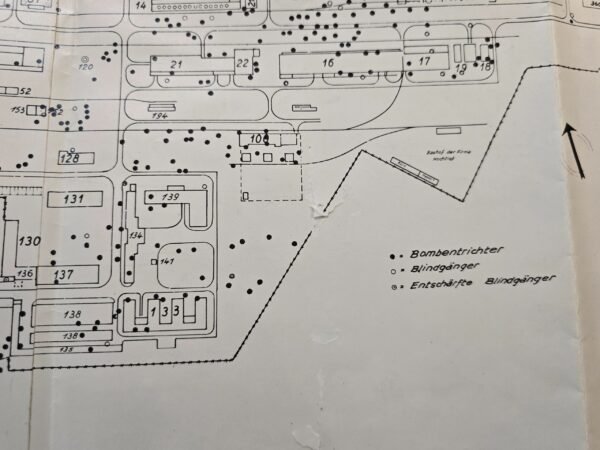
Legend / Key on map:
Bombentrichter
→ Bomb craters
Blindgänger
→ Unexploded bombs (duds)
Entschärfte Blindgänger
→ Defused unexploded bombs
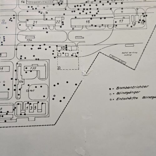
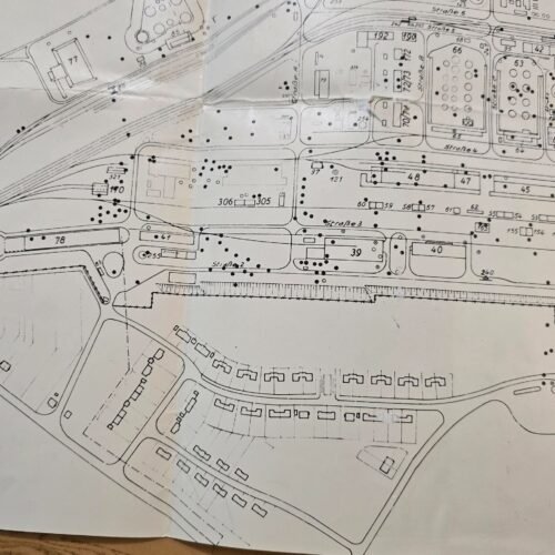
👉 The numerous black dots across the map represent actual bomb strike locations, making this a direct record of Allied bombing damage.
“Geheim” (stamp):
→ Secret
Partial translation:
→ “This is a state secret under the law of June 5, 1934… Distribution only via official channels… Storage under responsibility…”
👉 Confirms this was restricted wartime material, likely for engineering, repair, or military planning use.
What This Map Shows (Important Collector Insight):
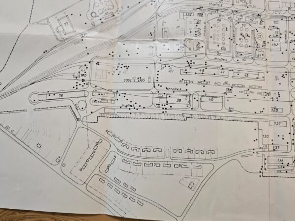
Detailed layout of a synthetic fuel / oil hydrogenation plant
Buildings, tanks, rail lines, and infrastructure all numbered
Heavy concentration of bomb hits across the facility
Rhine River labeled at top (“Rheinstrom”)
Industrial + worker housing area at bottom
Historical Context (Highly Relevant):
This plant was part of Germany’s synthetic fuel program, which was critical to the war effort (fuel for tanks, aircraft, etc.).
The Wesseling plant produced fuel from coal using chemical processes
It became a major Allied bombing target in 1944
Heavy raids occurred in June, July, and October 1944, causing severe damage and eventual shutdown
👉 Just 1–2 days before this map (July 18–19, 1944):
Allied bombers attacked synthetic oil plants including Wesseling
This strongly suggests:
👉 This map was likely created immediately after a bombing raid to document damage
What Was Happening on July 19, 1944 (Wider War Context):
Battle of Normandy ongoing
Allied forces pushing through France:
Liberation of Saint-Lô (major breakthrough)
Heavy tank battles near Caen (Operation Goodwood continues)
👉 This was a critical turning point in the war, when:
Allies were advancing on land
AND systematically destroying Germany’s fuel supply from the air
Condition:
Original large fold-out map
Fold lines present as issued
Light wear / handling marks consistent with age
No major loss of detail
See photos for exact condition
Collector Value / Significance:
Direct connection to Allied bombing campaign against fuel industry
Rare bomb damage plotted industrial map
Marked “Secret” wartime document
Identifiable strategic target (Wesseling oil plant)
Strong crossover appeal:
WWII collectors
Military historians
Industrial / engineering history collectors
Keywords (SEO for eBay):
WWII German map, bomb damage map, Wesseling refinery, synthetic fuel plant, Luftwaffe target, Allied bombing Germany, oil plant bombing, Rhein industrial map, German military document, geheim document, 1944 war map, bombing craters map, WWII engineering plan, Third Reich industrial, hydrierwerk map, German fuel plant, strategic bombing target, WWII artifact, original German map
| Weight | 0.01 lbs |
|---|
Related products
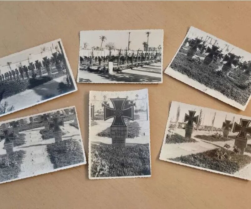
WW2 German Afrika Korps Soldiers KIA Cemetery w Iron Cross Swastika Graves Photo lot
Original price was: $49.99.$39.99Current price is: $39.99.
WW2 Nazi German Third Reich NSDAP Bismarck Poster Print Wochenspruch Wall Newspaper
Original price was: $25.00.$18.00Current price is: $18.00.
Reviews
There are no reviews yet.